
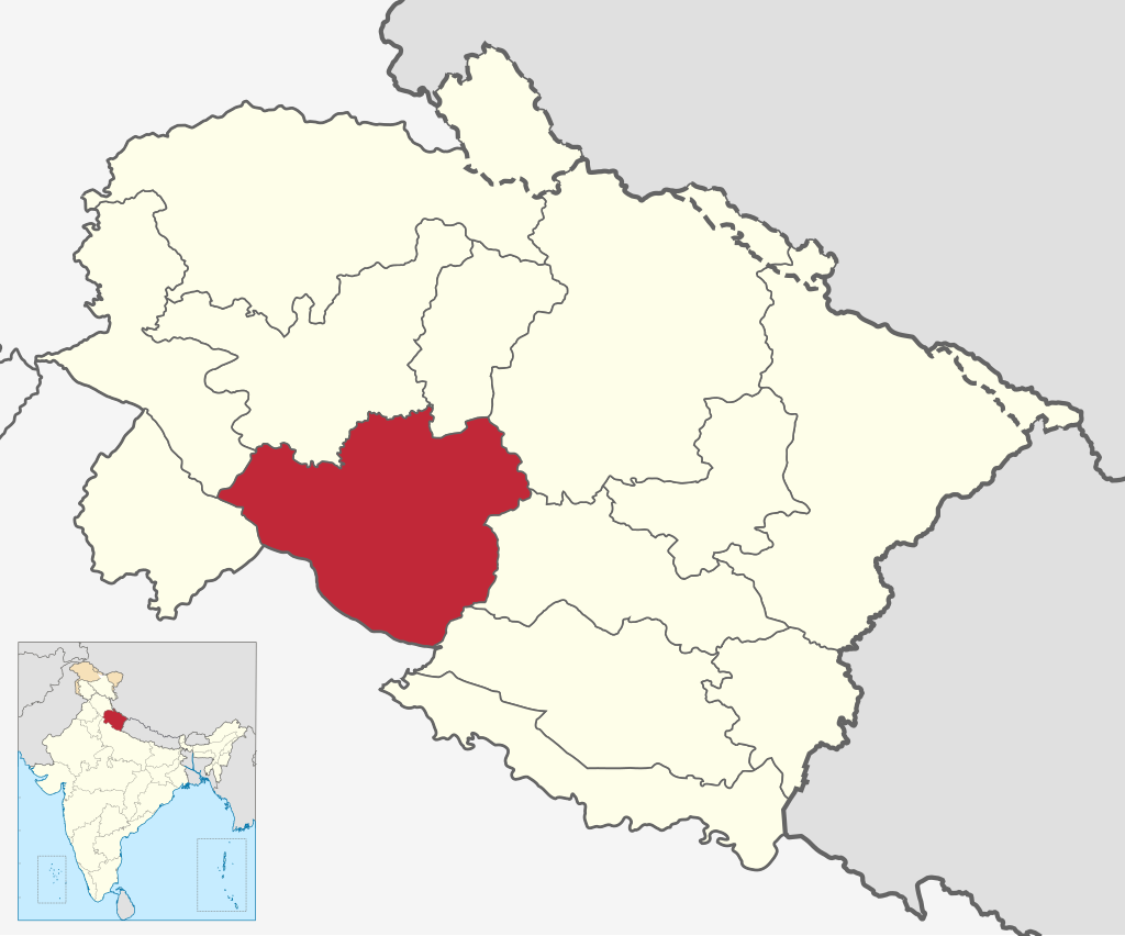
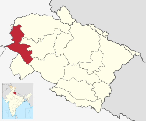
UTTRAKHAND
- Uttrakhand has a total of 13 districts, which are divided into two administrative division
Garhwal
The Garhwal division includes 7 districts,
- Chamoli
- Dehradun
- Haridwar
- Pauri Garhwal
- Rudraprayag
- Tehri Garhwal
- Uttarkashi
kumoan
The Kumoan division includes 6 districts,
- Almora
- Bageshwar
- Champawat
- Nanital
- Pithoragarh
- Udham Singh Nagar
Garhwal tourist place
Piligrimage sites ( Char Dham
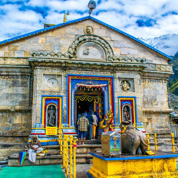
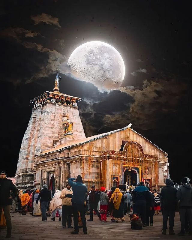
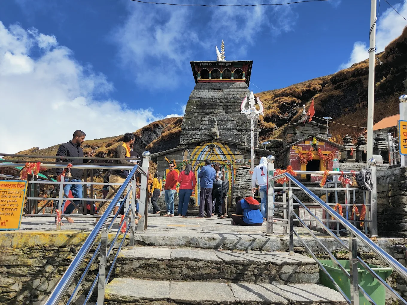
Kedarnath
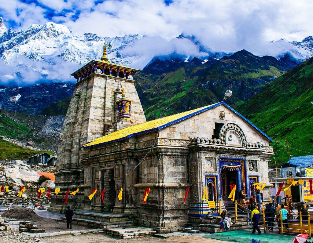
Kēdāranātha Temple (Sanskrit: केदारनाथ मंदिर, IAST: Kēdāranātha Mandira, lit. ’temple of the God of the field’) is a Hindu temple, one of the twelve jyotirlinga of Śiva. The temple is located on the Garhwal Himalayan range[1] near the Mandākinī river, in the state of Uttarakhand, India. Due to extreme weather conditions, the temple is open to the general public only between the months of April (Akṣaya Tritiya) and November (Kārtika Pūrṇimā, the autumn full moon). During the winters, the vigraha (deity) of the temple is carried down to Ukhimath to be worshiped for the next six months. Kēdāranātha is seen as a homogeneous form of Śiva, the ‘Lord of Kēdārakhaṇḍa’, the historical name of the region.[2]
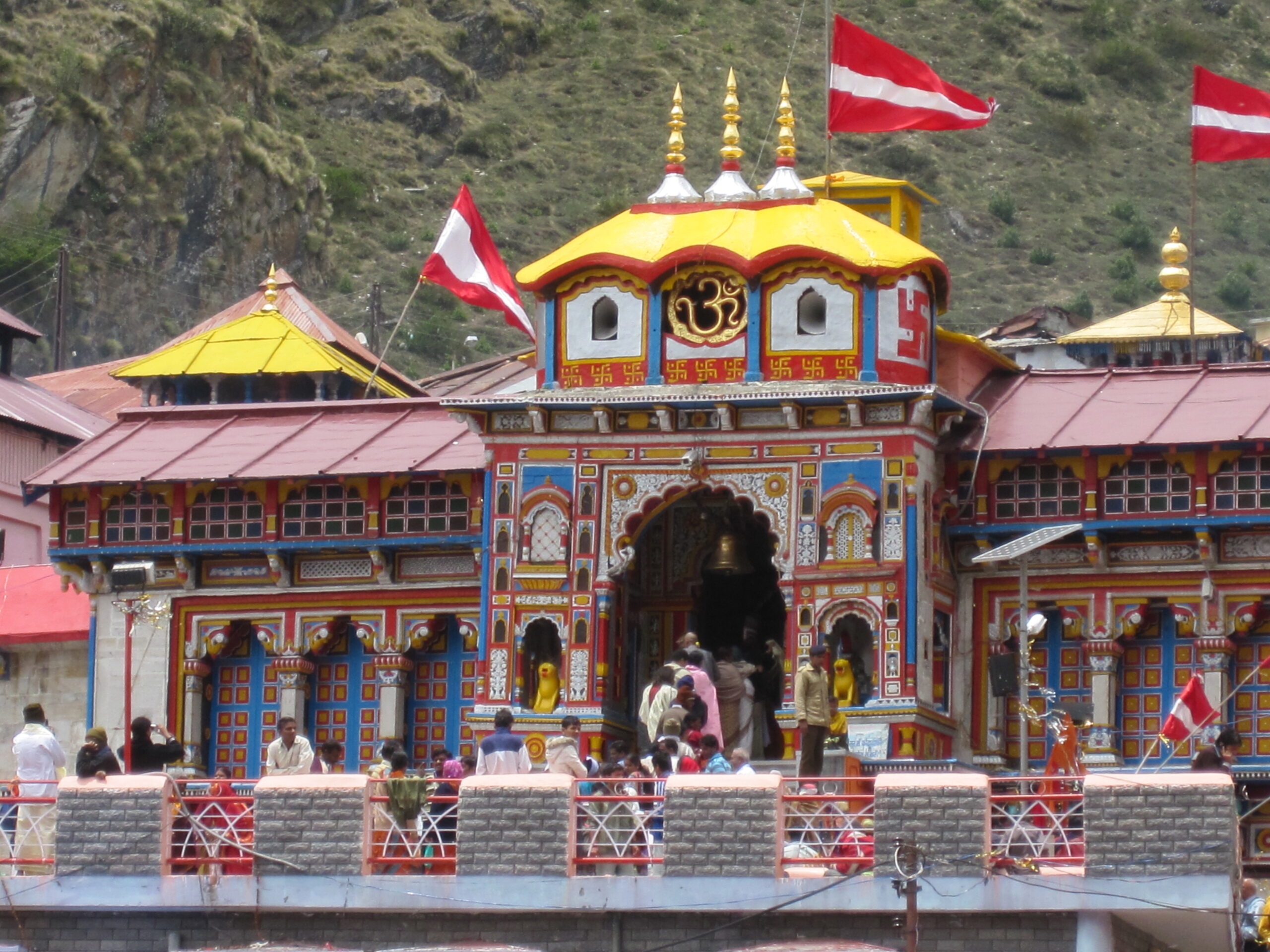
Badrinath
Badarinath or Badarinarayana Temple is a Hindu temple dedicated to Vishnu, located in the town of Badrinath in the Chamoli district of Uttarakhand, India. The temple is also one of the 108 Divya Desams dedicated to Vishnu for Vaishnavas, who is worshipped as Badrinath. It is open for six months every year (between the end of April and the beginning of November), because of extreme weather conditions in the Himalayan region. The temple is located in Garhwal hill tracks in Chamoli district along the banks of Alaknanda River. It is one of the most visited pilgrimage centers of India, having recorded 2.8 million (28 lakh) visits in just 2 months in 2022.[1] It is one of the Char Dham pilgrimage sites

Gangotri
Gangotri is a town and a Nagar Panchayat (municipality) in Uttarkashi district in the state of Uttarakhand, India. It is 99 km from Uttarkashi, the main district headquarter. It is a Hindu pilgrim town on the banks of the river Bhagirathi – the origin of the river Ganges. The town is located on the Greater Himalayan Range, at a height of 3,100 metres (10,200 ft). According to a popular Hindu legend, the goddess Ganga descended here when Shiva released the mighty river from the locks of his h
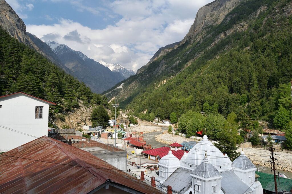
Yamunotri
Yamunotri Temple is a Hindu temple, situated in the western region of Garhwal Himalayas at an altitude of 3,291 metres (10,797 ft) in Uttarkashi district, Uttarakhand, India.[1] It’s just 129 km from Uttarkashi, the main district headquarters. The temple is dedicated to Goddess Yamuna, and has a black marble idol of the goddess.[2] The Yamunotri temple is a full day’s journey from Uttarakhand’s main towns — Uttarkashi, Rishikesh, Haridwar or Dehradun.
Adventure and nature tourism
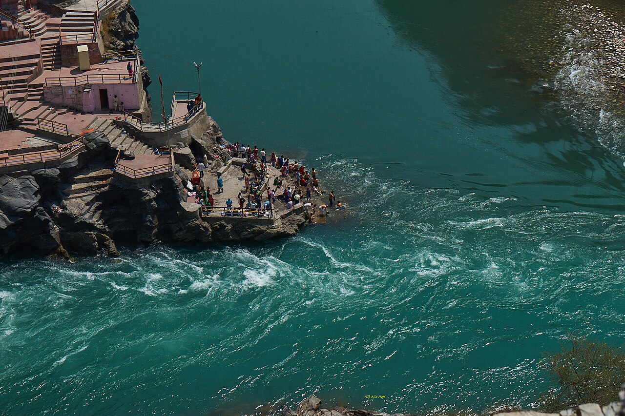
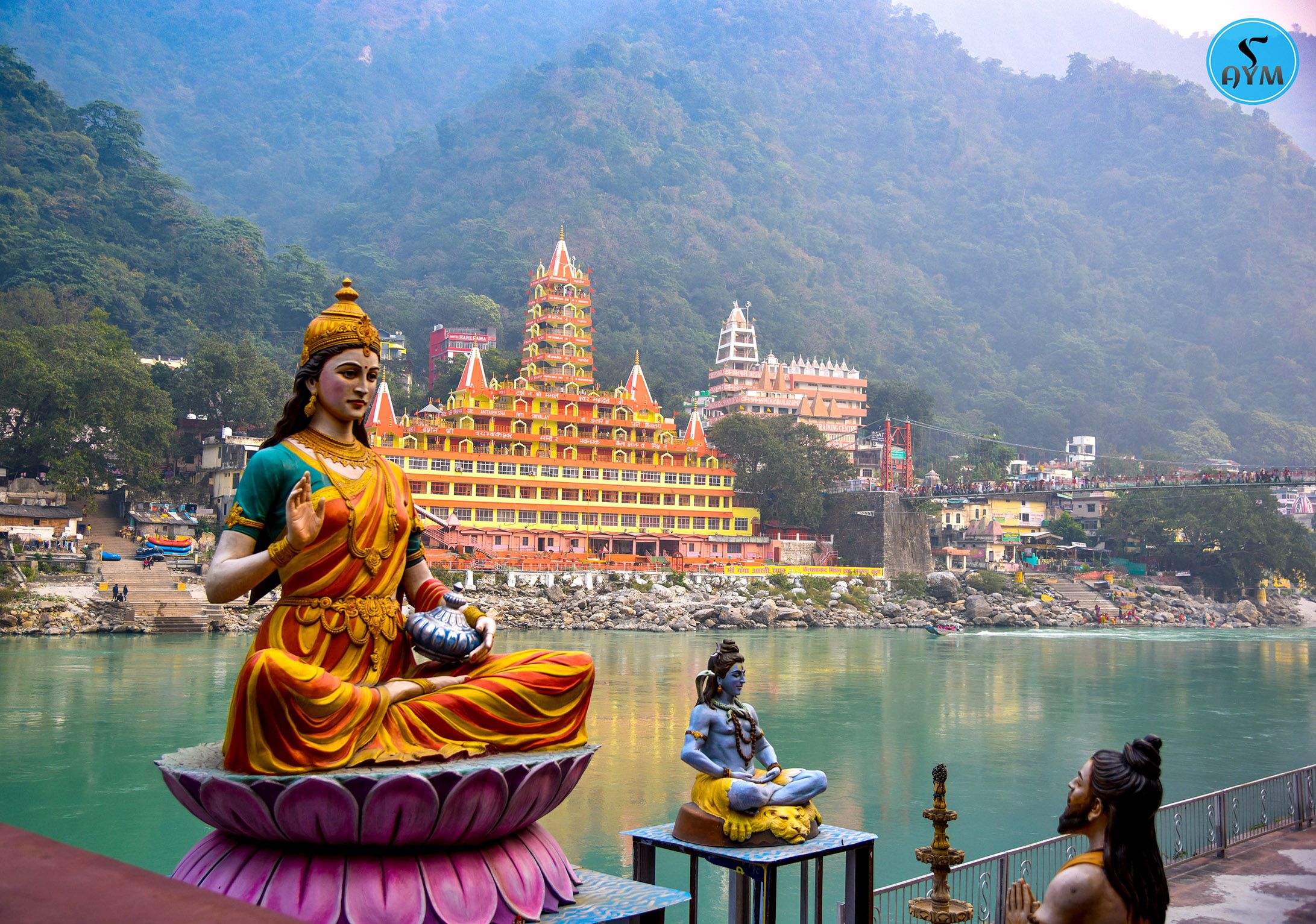
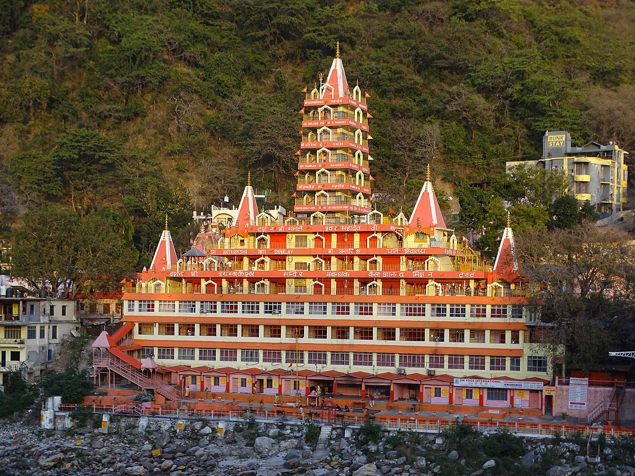
Rishikesh
Rishikesh, also spelt as Hrishikesh, is a municipal corporation and tehsil of Dehradun district of the Indian state Uttarakhand. It is situated on the right bank of the Ganges river and is a pilgrimage town for Hindus, with ancient sages and saints meditating there in search of higher knowledge.[1][2] There are numerous temples and ashrams built along the banks of the river.[3]
The city has hosted the annual International Yoga Festival on the first week of March since 1999, giving it the nickname of Yoga Capital of the World.[4][5] Rishikesh is a vegetarian-only and alcohol-free city.

Valley of flowers
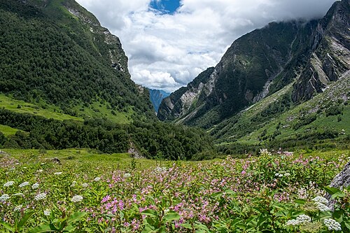
Valley of Flowers National Park is an Indian national park which was established in 1982. It is located in Chamoli in the state of Uttarakhand and is known for its meadows of endemic alpine flowers and the variety of flora. This richly diverse area is also home to rare and endangered animals, including the Asiatic black bear,[1] snow leopard,[1] musk deer,[1] brown bear, red fox[1] and blue sheep. Birds found in the park include Himalayan monal pheasant and other high-altitude birds.[2
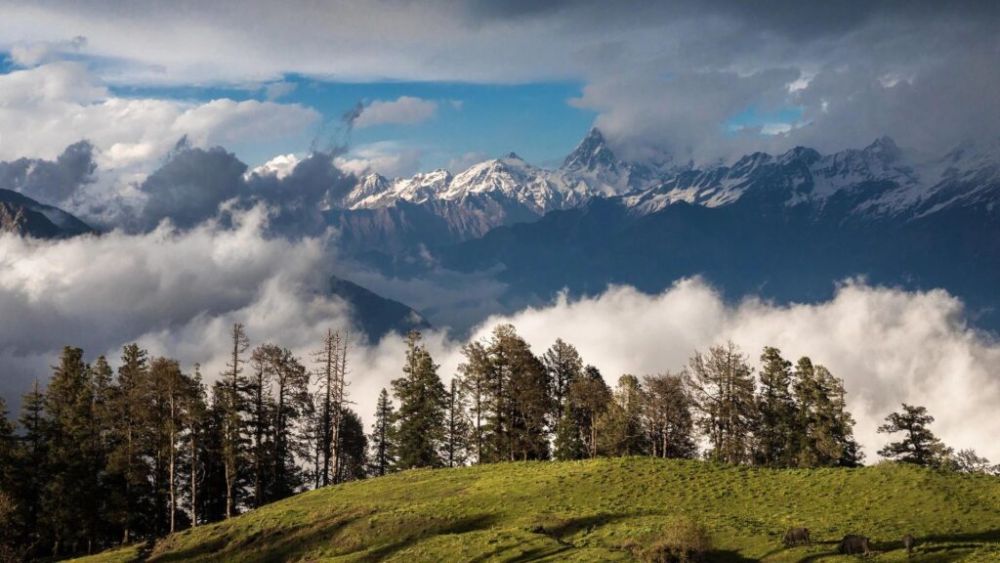
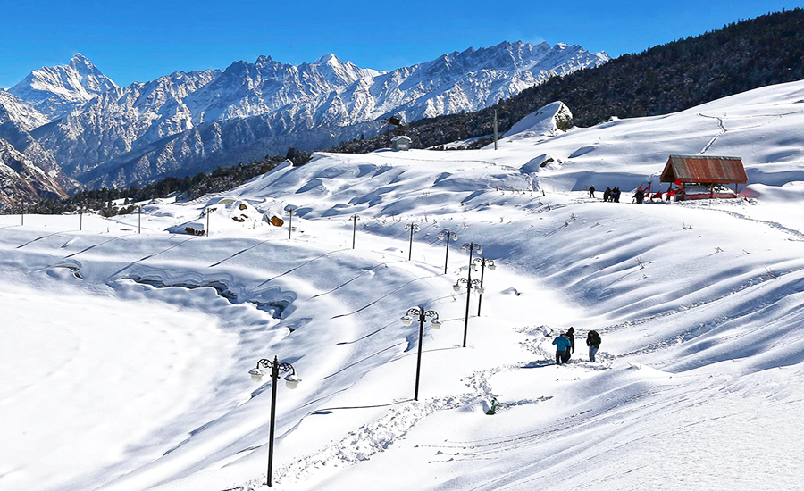
Chopta
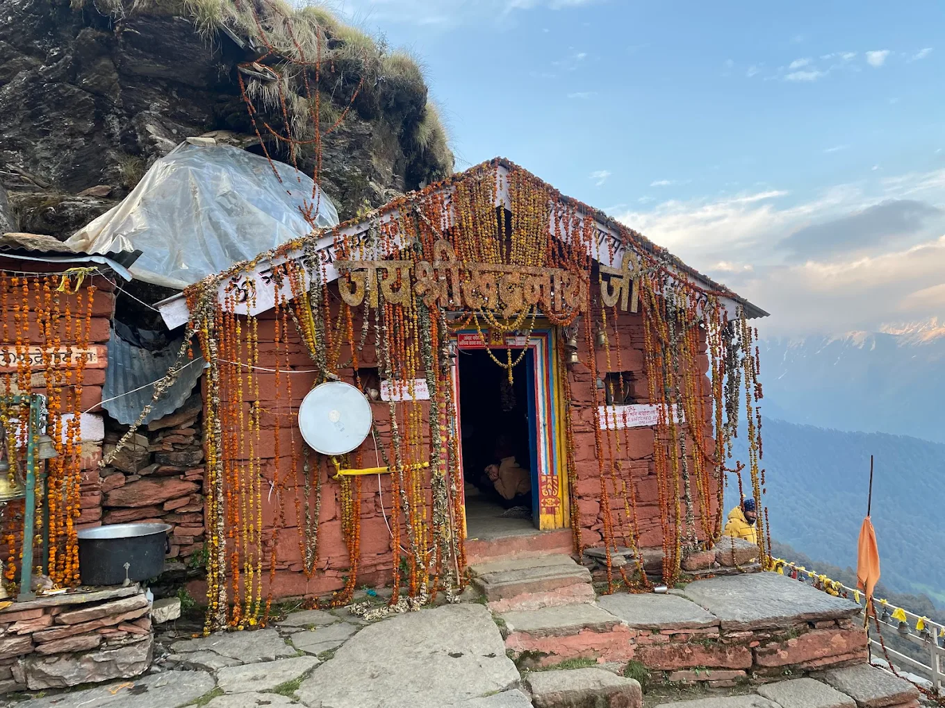
Chopta is a small region of meadows and evergreen forest area, a part of Kedarnath wildlife sanctuary located in Uttarakhand state, India and a base for trekking to Tungnath, the third temple of Panch Kedar which lies 3.5 kilometres (2.2 mi) away. Located at a distance of 1.5 kilometres (0.93 mi) from Tungnath is Chandrashila, a summit rising to over 4,000 metres (13,000 ft).
Chopta is an unspoiled natural destination lying in the lap of the Uttarakhand Himalayas and offers views of the imposing Himalayan range including Trishul, Nanda Devi and Chaukhamba. It is located at an elevation of 2,709 metres (8,888 ft) above sea level. Chopta village is surrounded by forests of pine, deodar and rhododendron and is rich in flora and fauna include rare species of birds and musk deer.
Hill statians
Mussoorie
Mussoorie (Hindi: [məsuːɾiː]) is a hill station and a municipal board in the Dehradun district of the Indian state of Uttarakhand. It is about 35 kilometres (22 mi) from the state capital of Dehradun and 290 km (180 mi) north of the national capital of New Delhi. The hill station is in the foothills of the Garhwal Himalayan range. The adjoining town of Landour, which includes a military cantonment, is considered part of “greater Mussoorie”, as are the townships Barlowganj and Jharipani.[3]
Mussoorie is at an average altitude of 2,005 metres (6,578 ft).[4] To the northeast are the Himalayan snow ranges, and to the south, the Doon Valley and Sivalik Hills ranges. The second highest point is the original Lal Tibba in Landour, with a height of over 2,275 m (7,464 ft).[5] Mussoorie is popularly known as The Queen of the Hills.[6][7]
Pauri
Pauri Garhwal district is a district in the Indian state of Uttarakhand. Its headquarters is in the town of Pauri. It is sometimes referred to simply as Garhwal district, though it should not be confused with the larger Garhwal region of which it is only a part of.
Dehradun
Dehradun district (Hindi: [d̪eːɦɾaːd̪uːn] ⓘ) is a district in Garhwal which is a part of Uttarakhand state in northern India. The district headquarters is Dehradun, which has also served as the interim capital of Uttarakhand since its founding in 2000. The district has 6 tehsils, 6 community development blocks, 17 towns and 764 inhabited villages, and 18 unpopulated villages. As of 2011, it is the second most populous district of Uttarakhand (out of 13), after Haridwar.[1] Dehradun district also includes the prominent towns of Rishikesh, Mussoorie, Landour and Chakrata. The district stretches from the Ganges river in the east to the Yamuna river in the west, and from the Terai and Shivaliks in the south and southeast to the Great Himalaya in the northwest. During the days of British Raj, the official name of the district was Dehra Dun.[2] In 1842, Dun was attached to Saharanpur district and placed under an officer subordinate to the Collector of the district but since 1871 it is being administered as separate district.
Spiritual and historical sites
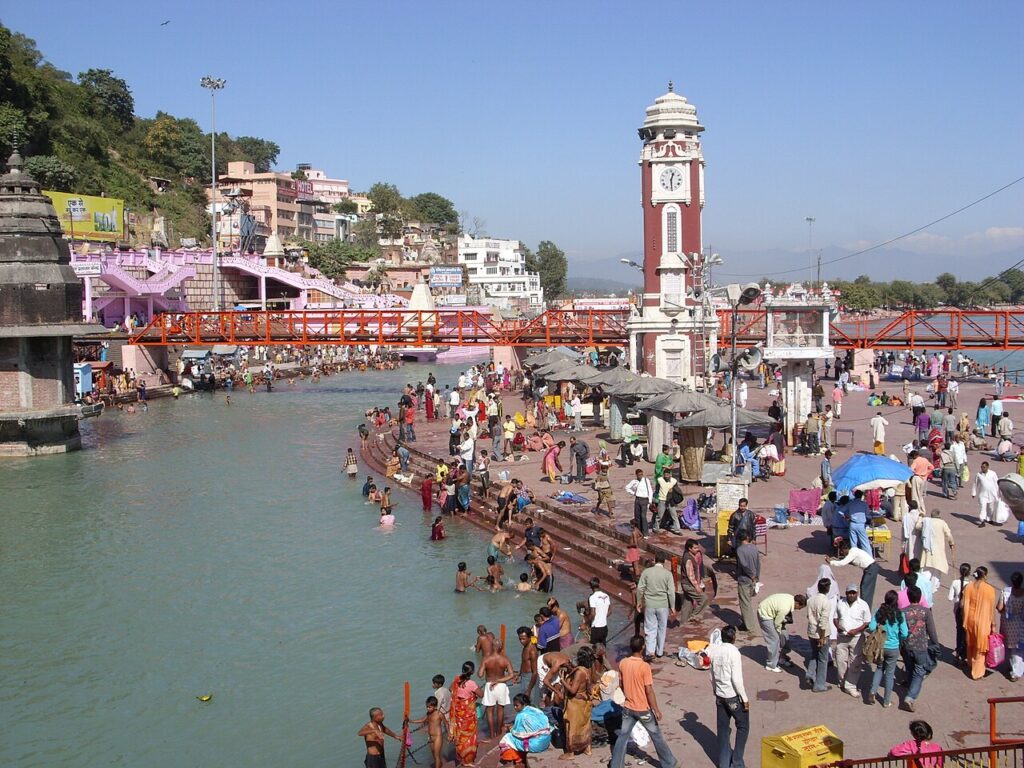
Haridwar
Haridwar district (Hindi: [ɦəɾɪd̪waːɾ] ⓘ), also spelled Hardwar, is part of Uttarakhand, India that lies in the Doab region, where people traditionally speak Khariboli. It is headquartered at Haridwar which is also its largest city. The district is ringed by the districts Dehradun in the north and east, Pauri Garhwal in the east and the Uttar Pradesh districts of Muzaffarnagar and Bijnor in the south and Saharanpur in the west.
Haridwar district came into existence on 28 December 1988 as part of Saharanpur Divisional Commissionary,[3] On 24 September 1998 Uttar Pradesh Legislative Assembly passed the ‘Uttar Pradesh Reorganisation Bill’, 1998′,[4] eventually the Parliament also passed the Indian Federal Legislation – ‘Uttar Pradesh Reorganisation Act 2000’, and thus on 9 November 2000,[5] Haridwar became part of the newly formed Uttarakhand (then Uttaranchal), the 27th state of the Republic of India.
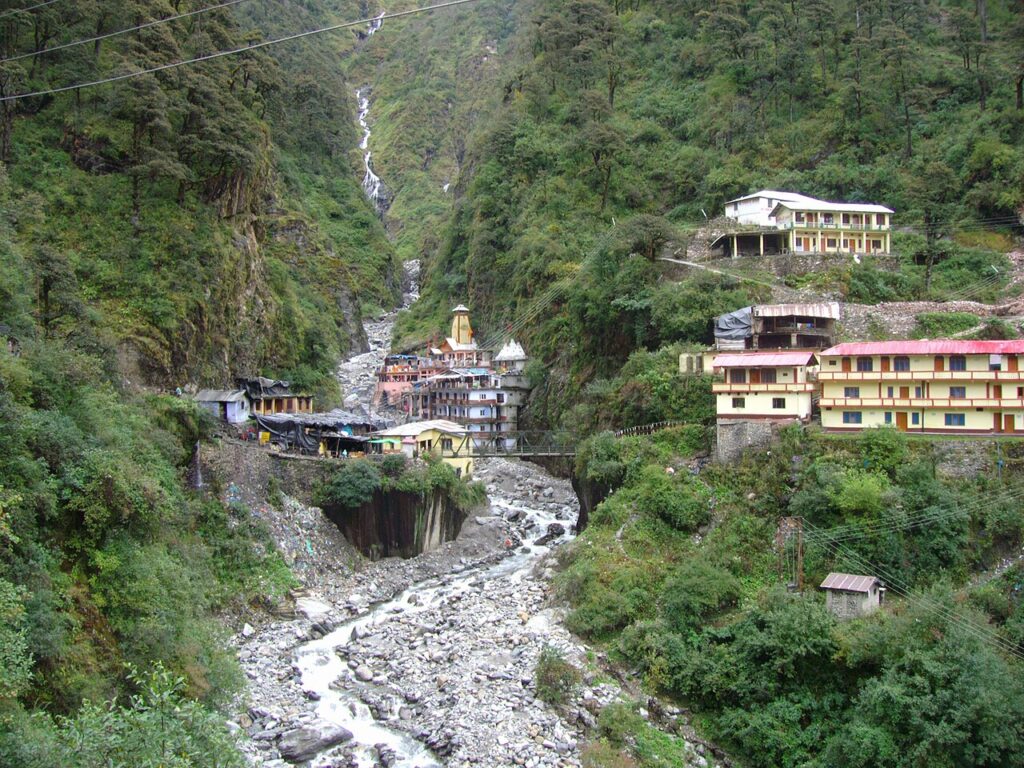
Devprayg

Devprayag (Deva prayāga) is a town and a nagar palika, near New Tehri city in Tehri Garhwal District[1] in the state of Uttarakhand, India, and is the final one of the Panch Prayag (five confluences) of Alaknanda River where Alaknanda meets the Bhagirathi river and both rivers thereafter flow on as the Ganges river or Ganga.
Joshimath
Joshimath, also known as Jyotirmath, is a town and a municipal board in Chamoli District in the state of Uttarakhand. Located at a height of 6,150 feet (1,875 m),[3] it is a gateway to several Himalayan mountain climbing expeditions, trekking trails and pilgrim centres like Badrinath.[4] It is home to one of the four cardinal pīthas believed by tradition to be established by Adi Shankara.[5]
Since 7 February 2021, the area was severely affected by the 2021 Uttarakhand flood and its aftermath. The town is confirmed to be sinking due to its geographic location being along a running ridge.[6][7
Kumaon tourist destinatians
Hill station and town
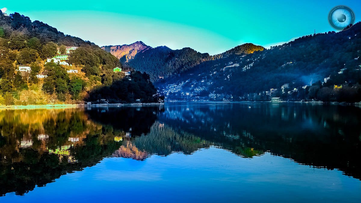
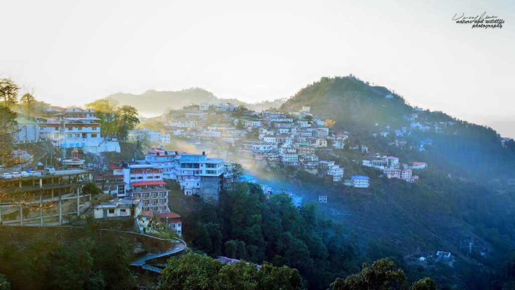
Nanital
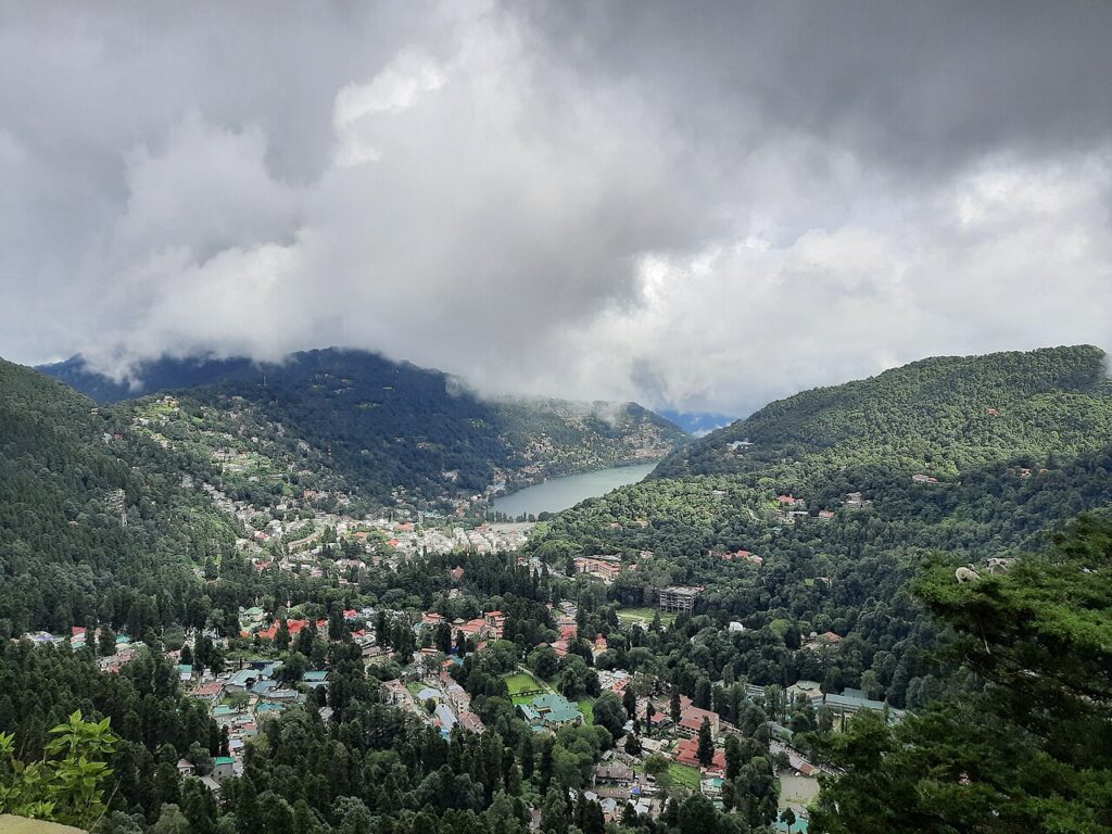
Nainital (Kumaoni: Naintāl; pronounced [nɛnːtaːl]), formerly anglicized as Naini Tal, is a town and headquarters of Nainital district of Kumaon division, Uttarakhand, India. It is the judicial capital of Uttarakhand, the High Court of the state being located there and is the headquarters of an eponymous district. It also houses the Governor of Uttarakhand,[7] who resides in the Raj Bhavan. Nainital was the summer capital[8] of the United Provinces.
Nainital is located in the Kumaon foothills of the outer Himalayas at a distance of 276 km (171 mi) from the state capital Dehradun and 314 km (195 mi) from New Delhi, the capital of India. Situated at an altitude of 1,938 metres (6,358 ft) above sea level, the town is set in a valley containing an eye-shaped lake, approximately two miles in circumference, and surrounded by mountains, of which the highest are Naina Peak (2,615 m (8,579 ft)) on the north, Deopatha (2,438 m (7,999 ft)) on the west, and Ayarpatha (2,278 m (7,474 ft)) on the south.
pithoragarh
Pithoragarh city and its surrounding areas were part of the Manaskhand region, which extended from the Kailash Mountain in the north to Bhabar & Terai in the south, as mentioned in the Skanda Purana.[3]: 12 The Asuras and Nagas appear to be the earliest inhabitants of the region, who were later superseded by the Kiratas, Khasas and the Kunindas.[3]: 13 The Kuninda Kings of the region may have become the feudatories of The Kushana Kings, who held their sway over the region in the last quarter of the 1st century AD.[3]: 16
Spiritual and historical sites
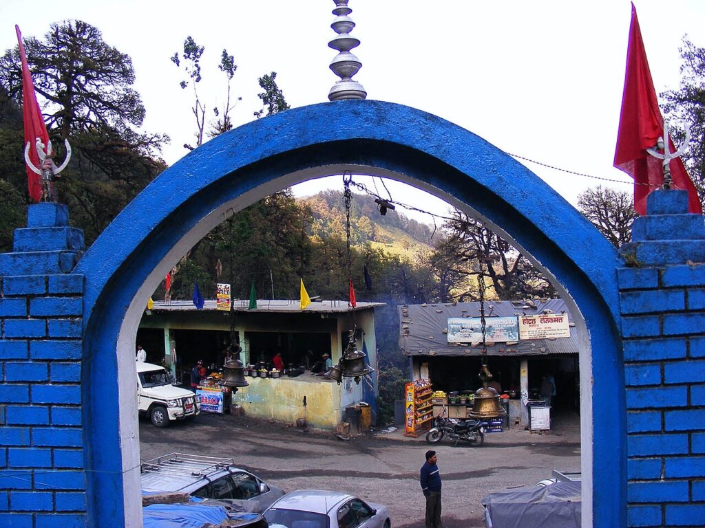
Kainchi Dahm
Kainchi Dham is a spiritual ashram and temple complex located in the Kumaon region of Uttarakhand, India, known for its association with Neem Karoli Baba, a revered Hindu saint.[1][2][3]
The ashram was established by Neem Karoli Baba in the 1960s on land donated by a local resident. Its name, “Kainchi,” which translates to “scissors” in Hindi, is derived from the two sharp hairpin bends in the mountainous road leading to the site and forming a scissor like shape.[4][5][6][7]
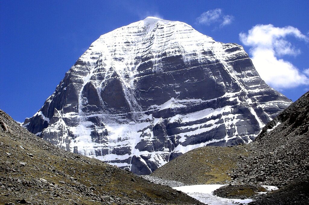
Mount Kailash
Mount Kailash (also Kailasa[a], Gang Tise[b] and Gang Rinpoche or Kangrinboqê[c]) is a mountain in Ngari Prefecture, Tibet Autonomous Region of China. It lies in the Gangdise Shan mountain range of the Transhimalaya, in the western part of the Tibetan Plateau. The peak of Mount Kailash is located at an elevation of 6,638 m (21,778 ft), near the western trijunction between China, India and Nepal.
Mount Kailash is located close to Manasarovar and Rakshastal lakes. The sources of four rivers: Indus, Sutlej, Brahmaputra, and Ghaghara lie in the vicinity of the region. Mount Kailash is sacred in Bon, Buddhism, Hinduism, and Jainism. People from China, India, Nepal, and other countries in the region undertake a pilgrimage to the mountain. The pilgrimage generally involves trekking towards Lake Manasarovar and a circumambulation of Mount Kailash.
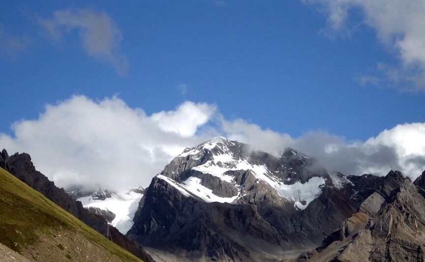
OM PARVAT
Om Parvat is a mountain located in Pithoragarh district, Uttarakhand, India.[2][3] Om Parvat’s peak elevation is 5,590 m (18,340 ft) above sea level.[4]
The meaning of Om Parvat
Om Parvat derives its name from the Sanskrit word Om, which is composed of three sounds: A, U, and M. These sounds represent the three states of consciousness: waking, dreaming, and deep sleep. They also correspond to the three realms of existence: earth, atmosphere, and heaven. The fourth state, beyond these three, is silence or pure consciousness, which is symbolized by the dot above the crescent in the Om symbol. Om Parvat is thus a representation of the ultimate reality that transcends the phenomenal world.
Offbeat and adventure destinatians
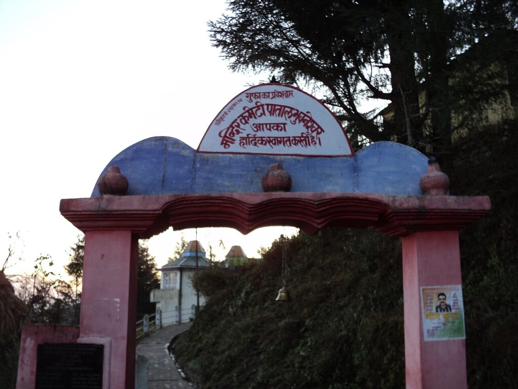
Patal Bhuvaneshwar
Patal Bhuvaneshwar (Hindi : पाताल भुवनेश्वर) is a limestone Hindu cave temple 14 km from Gangolihat in the Pithoragarh district of Uttarakhand state in India. It is located in the village of Bhubneshwar. Legend and folklore have it that this cave enshrines Lord Shiva and thirty three koti demigods [33 Types, In hindu neumerology “Koti” means “Types”]. The cave is 160 m long and 90 feet deep from the point of entrance. Limestone rock formations have created various spectacular stalactite and stalagmite figures of various hues and forms. This cave has a narrow tunnel-like opening which leads to a number of caves. The cave is fully electrically illuminated. Built by the flow of water, Patal Bhuvaneshwar is not just one cave, rather a series of caves within caves